
FLOAT VBC aims to provide public kayak and canoe launches on the floatable rivers in Van Buren County and to provide the information necessary to ensure that visitors and locals alike can have a safe and enjoyable trip exploring our county and local rivers.
For more information, please contact Jason Hayes at info@floatvbc.com or 501-745-6500.
NOTE TO VISITORS: Please be respectful of your natural surroundings, and the landowners of the surrounding properties. When you visit a site, make sure to leave it as you found it. Clean up any trash and be sure to collect any sporting/camping equipment you bring.
Paddlers should understand their own abilities and use this knowledge to judge if river conditions are safe to float for their experience level.
Bluffton
Upper launch of Archey Fork to Clinton City Park (INTERMEDIATE FLOAT, 4-6 hours)
Hiking/Biking: Single-Track Trails
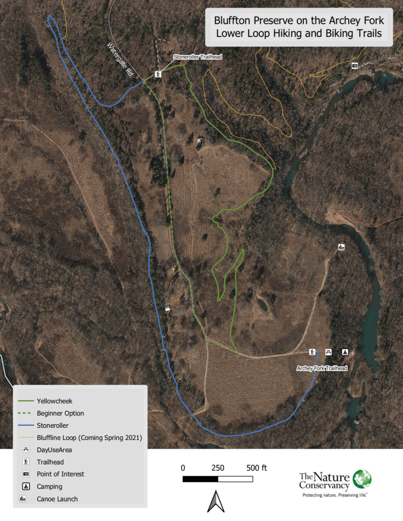
Only minutes from downtown Clinton lies the Bluffton Preserve, a 985-acre tract of field and forest in the upper Little Red River Watershed. Coursing through it is nearly four miles of the beautiful Archey Fork of the Little Red River.
Directions
The Bluffton Preserve is located at the end of Watergate Road, just 6.5 miles north of Clinton on Hwy 65 N. Turn on Watergate Road, by the Bluffton Cemetery, and continue for 3.8 miles, staying right at both intersections (follow directional signs).
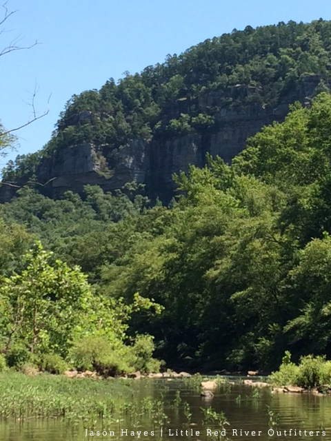
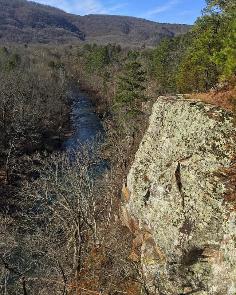
The Bluff line you see when entering the property make it clear how the preserve got its name. To truly capture the beauty of the bluff line it is best to visit the preserve in the afternoon when the sun has moved from behind the Bluff line to behind your back lighting up this breath taking formation. While the Bluff line is worth the trip and is sure to be a draw it barely scratches the surface of what all the preserve has to offer. Bluffton is perfect for hiking, camping, fishing, bicycling, geocaching, kayaking, swimming or just exploring; the preserve provides a little something for everyone. It also serves as a demonstration site for a variety of conservation practices geared toward clean water and sediment reduction such as prescribed fire, unpaved roads best management practices and reforestation.
Float, Bike, Hike, and Camp!
This hidden treasure of nature is nestled right along the Archey Fork River making it perfect for swimming, fishing, and kayak launch spot. There are a number of large swimming and fishing holes easily accessible from the road and with camping within walking distance of the river you can take the time to experience all Bluffton has to offer if you wish.
Bluffton serves as the upper kayak launch for the Archey Fork River with the next pickup area, 9.5 miles in the Clinton City Park. This float will take roughly 4 to 6 hours depending on river conditions and pace of the group. This secluded float will let you reconnect with nature and provides a number of rapids. This float is not advised for most beginners due to the length and the presence of narrow rapids and high current when water levels are up and rocks exposed in the rapids creating a boney affect making for a longer paddle time when water levels are down.
Wildlife Paradise
Bluffton is home to a variety of wildlife with the most notable being the yellowcheek darter, known only to swim in the waters of the upper Little Red River, can be found in the Archey Fork, along with an impressive suite of rare species. Bald eagles and osprey are a common site in the winter, while deer and turkey are prevalent year around. And let’s not forget the smallmouth bass!
PLEASE NOTE: The Nature Conservancy is allowing the public to use the Bluffton property as a kayak and canoe launch to help educate and bring appreciation to the outdoors, local rivers and their efforts to preserve these natural resources. The Nature Conservancy request that the property is left the way it is found. The use of The Nature Conservancy property is a privilege and should be treated with respect to insure future use of the Bluffton property.
The Bluffton Preserve is still relatively unknown, making for less distractions letting you truly experience nature. With a number of trails established as of July 2020 and more in progress there is a hiking or biking trail for all experience levels. The trail development system is single track in format and with some true backcountry trails and views you are guaranteed no to be disappointed.
The neighbors along Watergate Road and volunteers with Float VBC help us manage and maintain the property. Camping is available on a first come, first serve basis. The hunting rights are leased, so please refrain from hunting and be sure to wear your hunter orange when exploring during hunting season. We ask that you refrain from riding horses and ATVs in the area to help reduce the amount of sediment entering the river. And lastly, please enjoy but leave no trace!
Middle Fork
Shirley City Park to Sandiff (Recommended) Casual/Intermediate, 4-6 hours
HIKING/BIKING: M&A Railroad Trail, Ozark Grinder Trail
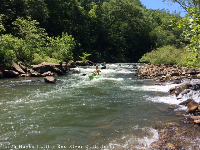
The Middle Fork of the Little Red River, located in Shirley, Arkansas, is a hidden treasure nestled in the foothills of the Ozark Mountains. This premier floating destination is ideal for your casual to intermediate floater. This cozy river offers amazing scenery, premier fishing, holes large enough for relaxing, and rapids that are sure to make it a trip to remember.
HIKING/BIKING: Retrace the Historic Railway
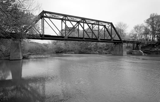
The Middle Fork floats offers a number of unique characteristics due to the rail road bed running the river, that was abandoned by the Missouri and North Arkansas Railroad that ran between Joplin and Helena. There is still one active bridge from the railroad days being used in Shirley and a number that were abandoned after the flood of 1982. This railroad bed has many uses from ATV trail riding to being the bottom end of the Ozark Grinder Trail (a mountain bike trail stretching 125+ miles from Tyler bend north of Marshall to Shirley).
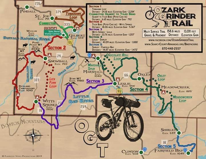
The O.G.T. boasts over 100 miles of wilderness bike trails with 10,000 elevation gain! Trace through some of the most fantastic views in the Ozark foothills.
There are currently four launch points on the Little Red River with float trips ranging from 3 and a half hours and up (float time can be affected by factors such as water level, pace of the group among others). These float trips provide picture perfect views and a chance to unwind and disconnect from your every day worries.
The Middle Fork of Little Red River floats have different stages of floating and each one provides a unique trip.
- I. low level floatable. This stage is from the lowest point floatable to about ¾ of a foot above its lowest point on the USGS gauge. During this stage floaters can expect numerous bends, rapids, and fishing holes. Through the rapids at this stage floaters at times will have to determine the best way through the rapids as to not drag but is still challenging enough to enjoy. The holes at this level will have less current than at high levels making for a little more paddling. This and the second stage are the best stage for fishing and the low current allows you to maintain position in fishing holes and the ability to paddle up stream.
- II. Approximately ¾ of a foot above low floating level to approximately 1.5 feet above low floating level. This level keeps the same path as the first stage but with a significant amount more current making the rapids larger and more exciting. At this level the holes have moderate current making for less paddling thorough the holes and at this level the sedimentation is starting to clear making it ideal for fishing.
- III. Approximately 1.5 feet above low floating level and above. At this stage the river begins to go over the sand bars instead of around them providing a straightening of the river. At this level you will still have access to an abundance of rapids but they are with high current and increased risk. This level is not ideal for fishing due to the high sedimentation levels in the water.
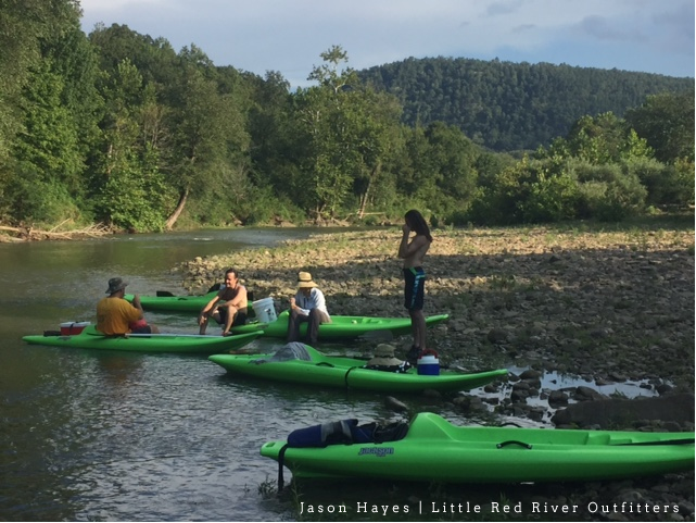
We have identified two public launch points on the Middle Fork of the Little Red River. The first launch point is the Shirley City Park: this site perceived to be the epicenter of the traffic for floating on this river. The city park offers one downstream float that is 7.2 miles and has about four hours of paddle time but groups can expect to spend five hours or more. This float is the lowest rated due it being the last float before the river dumps into Greers Ferry Lake. This float provides a number of large holes and can have no current on the bottom of the float if the levels are high on Greers Ferry Lake backing the lake up into the river. This float ends at the Corps of Engineers parking lot and boat launch at Sandiff.
Going Upstream
There are three readily available floats up stream, but due to public parking still being established, they are only accessible through shuttle.
- Alberg to Shirley is a 15 mile float and has a paddle time of 9 hours. This float offers an abundance of rapids, scenic beauty, swimming, fishing, and a number of photo opportunities. This floats launch is also the western entry to Meadow Creek (an old architectural college from the 70’s).
- Lydalisk to Shirley is a 9.7 mile float and has a paddle time of 4.5 hours. This float offers a number of exciting rapids, scenic beauty, fish, and swimming.
- River Road to Shirley is a 5.1 mile float and has a paddle time of 3 hours but floaters can expect to spend 4 hours on this float. This float offers a number of exciting rapids, scenic beauty, fish, and swimming.
South Fork
Archey Fork Park (Clinton) to Johnson Hole | SEASONAL Intermediate Float, 2.5 hours
Hiking/Biking: Archey Fork Riverwalk/City Trails, South Fork Nature Center
The South Fork float begins at Archey Fork Park in Clinton (Public launch) to Johnson Hole Corps Of Engineers parking lot and boat launch (public launch). This float is approximately 4.5 miles and has a 2.5 hour paddle time. This float offers a number of good fishing holes, scenic beauty, and swimming. This section of the river was dredged after the flood of 1982 to allow water to drain into Greers Ferry Lake without backing up and flooding Clinton. As a result of this dredging the river is wider than normal.

This float is seasonal and it is important to check river levels before attempting to float the Archey Fork. To check river levels Google USGS Arkansas river levels, once on that site chose statewide steam flow table or visit http://waterdata.usgs.gov/ar/nwis/current/?type=flow which monitors the water levels daily. Once on the USGS site locate the South Fork of the Little Red River at Clinton. When the corresponding numbers for this monitoring station reads 5 feet the river is low flow floatable and should take approximately 4 ½ hours any readings above that and up to 6.5 feet is perfect for floating. When the river is at 6.5 feet this float should take approximately 2 ½ hours. River levels from 6.5 to 9 feet produce quite a bit of white water and are not suited for anyone that is not an experienced paddler. River levels above 9 feet or below 5 feet are not advisable.

Notes on Float VBC
Float VBC is brought to you by collaborative effort of the Clinton Area Chamber of Commerce, the City of Clinton, the City of Shirley, and Van Buren County.
The Clinton Chamber of Commerce in an effort to increase tourism and make Van Buren County more of a destination has been working with public and private organizations to develop our infrastructure for floating in Van Buren County. Through this process we have found that there is more usage of the rivers for floating than was commonly known about. This floating is being done with limited access to launch and take out points so with an infrastructure in place and proper promotion it is the Chamber’s belief that floating can be an instrumental piece of economic stability for our area. In addition to working with the county, city and private parties to secure launch points the chamber has cataloged river conditions to better promote the rivers when it is optimal for floating.
The rivers in our area are monitored multiple times a day through http://waterdata.usgs.gov and with the rivers cataloged for floating conditions we can educate potential floaters and provide them with the information they need to insure they have a good experience.
